
Software
Gorizont Geotechnical Solution software platform
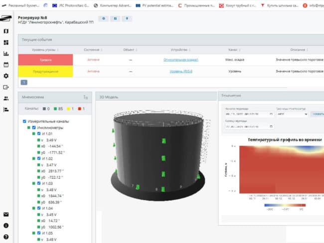
Software platform for acquiring measurements and monitoring facility condition. Combines archives, charts, a 3D model, defects, and monitoring events.
Software
Features and integration
Brings measurements and facility information into one workspace: instrument readings, manual observations, charts, defects, and events. Sensors can be linked to elements of a 3D structural model.
Operators use a browser. The server runs on Linux; analytical modules and computing resources are selected for measurement volume, facility count, and processing tasks.
Technical documentation
Operating manual (RU)On the manufacturer’s website (RU)Features and environment
Key features
- Measurements
- Instrument readings and manual entry
- Data processing
- Archive, processing, charts, and export
- Facility model
- BIM / 3D, sensors and defects linked to facility elements
- Events
- Event log and alerts
- Operating system
- Linux
- Configuration / measurement storage
- PostgreSQL / ClickHouse
- Operator access
- Browser access
- Deployment
- Docker; Nginx web server
- Computing resources specified by the manufacturer
- x64, at least 6 cores; at least 8 GB RAM; 3 × 2 TB drives
Key manufacturer data is shown. Configuration and resource requirements are confirmed for the project.
Full manufacturer data (RU)Descriptions, specifications, and images: NTP Gorizont materials.Manufacturer resources (RU) ↗
New project
Let’s discuss your task
Tell us about the facility, the current system, and what needs to change. We will clarify the details and suggest the next step.